Click here to sign up for our free daily newsletter
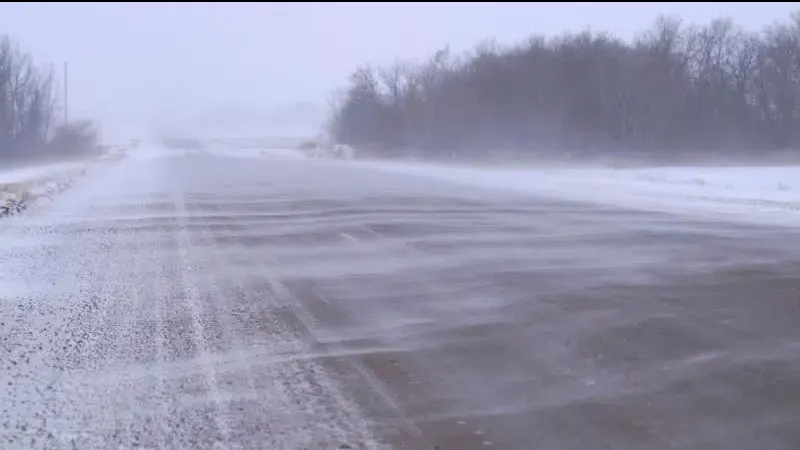
(Brady Lang/ CKOM Staff)
Snow is coming

Snowy, windy conditions expected for much of Tuesday

Dec 8, 2025 | 3:24 PM

A weather system blowing through the province will bring some freezing rain, snow, and windy conditions to parts of the province.

Because of that, most areas are under a Special Weather Statement from Environment and Climate Change Canada.

Meteorologist James Colangelo told northeastNOW a low-pressure system in Alberta will track east into Saskatchewan overnight.

The system will bring a variety of conditions, with its effects depending on location and the temperature experienced.

Colangelo said Melfort and the northeast could see five to 10 cm of snow on Tuesday, with the upper limit more likely.

“It does look like there’s an intense band of snow that makes its way through the area, kind of noon into the early afternoon hours,” Colangelo said.

Similar amounts should fall in the Prince Albert region. Colangelo anticipates quite a bit of snowfall in a relatively short period Tuesday afternoon.

Some regions of the province will experience much windier conditions. Colangelo said the Battlefords area will likely see less snow, but stronger winds, with gusts expected to reach 60 km/h at times on Tuesday. Meanwhile, parts of southern Saskatchewan near Swift Current could see gusts of 70 km/h or more.

Those conditions could mean a very challenging drive on Tuesday.

“Any time you get snow followed by strong winds, especially from the northwest here, that snow likes to blow around,” Colangelo said. “Definitely keep careful on the roads as you’re driving tomorrow afternoon especially through those central regions.”

Residents in Humboldt and Yorkton could have to keep their snowblowers handy. Colangelo said they could experience 10 to 15 cm of snow or more by the time the system leaves the province.

There could be further updates or warnings issued as the system approaches, and Colangelo said it’s difficult to nail down exactly what will happen with the system still in Alberta.

“It can be quite challenging, especially with these systems that can produce multiple types of weather.”

Colangelo added the conditions can change drastically depending on how far the warm air makes it into Saskatchewan, and conversely how far the cold air dips down from the north.

“It all depends on that track as the system moves through, especially with a system like this where it really hasn’t developed yet,” Colangelo said.

There could be more snow on the way this week, with more white stuff expected overnight on Wednesday. That will be followed by cooler conditions, with overnight lows approaching –30 C later this week.

cam.lee@pattisonmedia.com